What is PostGIS in PostgreSQL?
It would not be wrong to say that PostGIS is an open source software program that supports geometrical features for object relational database.
We use PostGIS together with postgresql. Thanks to PostGIS, we can store the polygon, linestring and point types of the data in the database. We can say that Polygon symbolizes a certain region and linestring is a particular line segment between two locations.
We describe the PostGIS installation on PostrgreSQL 12 step by step below.
How to Install PostGIS in PostgreSQL 12?
Step1: Download RPM Packages
In the first step, we download RPM packages.
1 | sudo yum -y install https://download.postgresql.org/pub/repos/yum/reporpms/EL-8-x86_64/pgdg-redhat-repo-latest.noarch.rpm |

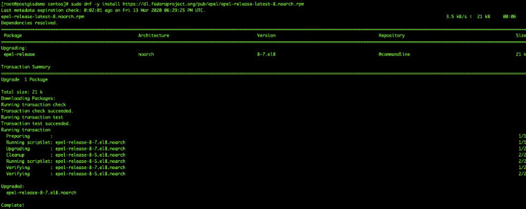
1 | sudo dnf -y install https://dl.fedoraproject.org/pub/epel/epel-release-latest-8.noarch.rpm |

Step2: Enable PowerTool
1 | sudo dnf config-manager --set-enabled PowerTools |
![]()
Step3: Disable default PostgreSQL AppStream Repository
1 | sudo dnf -qy module disable postgresql |
![]()
Step4: Install PostGIS
1 | sudo yum install postgis25_12 |

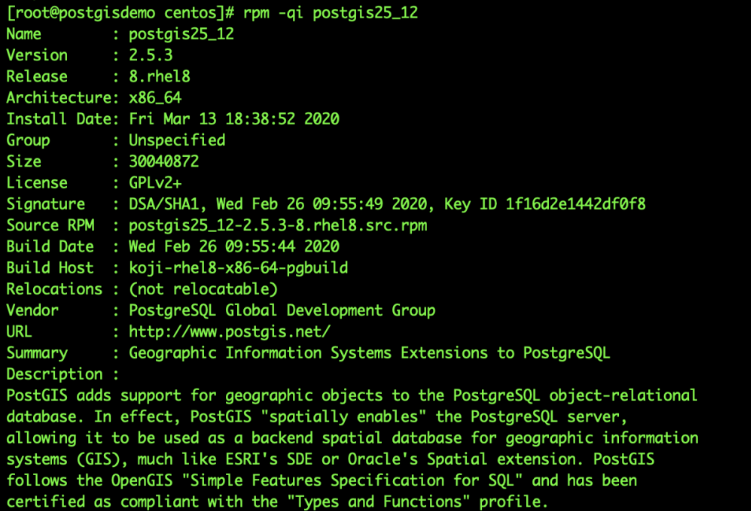
This will install PostGIS v2.5 for PostgreSQL 12.
1 | rpm -qi postgis25_12 |

Step5: Create Extensions
After the necessary installations are completed, let’s create EXTENTION now.
1 2 3 4 5 6 7 8 9 | su - postgres createuser demo_usr createdb demo_postgis -O demo_usr -- connect psql psql -d demo_postgis CREATE EXTENSION postgis; |

Step5: Check PostGIS Version
1 | SELECT PostGIS_version(); |

Let’s query the library versions it uses.
1 | select PostGIS_Full_Version(); |

Examples
We start our examples by creating a table with an Id and Geometry column below.
1 2 3 4 5 6 | create table table_a ( id serial NOT NULL, geo geometry, CONSTRAINT tableA_pkey PRIMARY KEY (id) ); |
Let’s add a column to the table_a table with the AddGeometryColumn function, which has a position of 4326 in the geographic coordinate named geo2 and will contain two-dimensional coordinates.
1 | SELECT AddGeometryColumn ('public','table_a','geo2',4326,'POINT',2); |

Create a point with the geomfromtext function
1 2 | insert into table_a (geo) select st_geomfromtext('POINT(30.8618697 36.9090847)',4326); |
Create a point with the makepoint function and define projection with setsrid
1 2 3 | select st_setsrid( st_makepoint(32.8618697,39.9090847),4326 ); |

Creating geometry from geojson
1 2 | insert into table_a (geo) select st_geomfromgeojson('{"type":"Point","coordinates":[32.7703187,39.9449081]}'); |
Creating geometry from kml
1 2 | insert into table_a (geo) select st_geomfromkml('<Point><coordinates>32.770318699999997,39.944908099999999</coordinates></Point>'); |
Create a line with the makeline
1 2 3 4 | insert into table_a (geo) select st_makeline( st_geomfromtext('POINT(32.8618697 39.9090847)',4326), st_geomfromtext('POINT(33.8618697 39.9090847)',4326) ); |
Create a polygon with makepolygon
1 2 | insert into table_a (geo) SELECT ST_MakePolygon(ST_GeomFromText('LINESTRING(75.15 29.53 1,77 29 1,77.6 29.5 1, 75.15 29.53 1)')); |
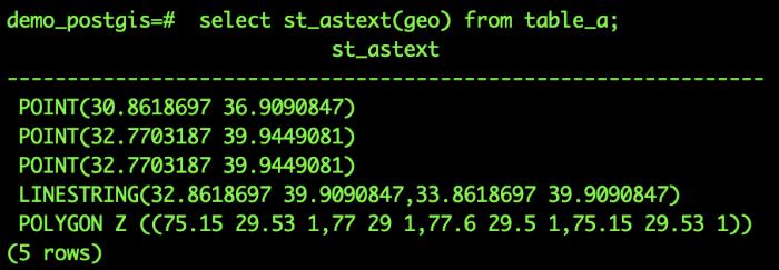
Outputs geometry in wkt format
1 | select st_astext(geo) from table_a; |

Outputs geometry in geojson format

Output in kml format
Projection information must be defined for kml

For PostGIS documentation ; https://postgis.net/stuff/postgis-2.5.pdf
![]()
 Database Tutorials MSSQL, Oracle, PostgreSQL, MySQL, MariaDB, DB2, Sybase, Teradata, Big Data, NOSQL, MongoDB, Couchbase, Cassandra, Windows, Linux